Nos camiños, a trama rururbana
- A trama rurubana
An intervention in a waiting for construction solar of a neighbourhood created around a factory. Nowadays this factory (before a porcelain factory) is closed and the solar is being built on: The intervention consists on
a. -An occupation of an advertisement board in front the factory showing an after and before image of the public life in the neighborhood.
b. -A working model of the floor where the factory is, situated in a solar in front of it, to finish with the suggestions of the people from the neighborhood.
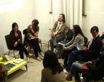
"Nos camiños" ("on the road") took place in Cabral, a neighbourhood of Vigo (Galicia). The project has two parts: a site-specific installation occupying an abandoned solar of the old Álvarez factory and a workshop held by María Lois (politic geographer) and Carme Nogueira (artist).
The workshop was focus on the roads (paths) that communicate this neighbourhood with the centre of the city. Nowadays the main street of this neighbourhood is the old path to Madrid. But there are more paths. One of them is the river that goes from this place to the centre. This path is now no used. The river is related to the agricultural past of the place, a recent past. The workers of the factory were also farmers. But there is another important fact: the rural claim was used in others villages and cities in Galicia to rebuilt them. Allariz is the most well known example. Vigo is considered to be the contra model of this idea. It is an urban city with a chaotic urban development. But, as we can see in this area, the rural is also present. And it has a big importance in the day
a day life.
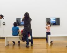
The site-specific installation tried to reclaim, just for a period of time, the communitarian use of the factory. It was the centre (economic, spatial and as an identity locus) of the neighbourhood. We can also say that it was created by the factory: the church, flats, shops were built by or because the factory. The time in this area depended on the timetables of the factory. This story can also be seen through the paths that communicate the factory with another quarters in the city and other villages nearby.
In the relation of abandoned/consolidated paths we can see abandoned/consolidated ways of life. Some activities (economic, social) were priorizated instead of others. In this case, the communitarian life is disappearing and a centralistic development is taking place. The street that goes from the centre of the city to the highway is built just in the borders without taking into account the area and the communitarian necessities. This urban growth makes local relations more complicate. In the model these questions are visible. The centre of the model is the solar of the factory. The solar has in one side the river and in the other side the centralistic urban development I depict before. People who see the model will see the back view of the typical view of the area. Instead of the buildings, will see the rural structure behind the buildings: instead the abandoned factory, the river. The river as a mythic place, in someway, is not finished in the model. I asked the people to complete this model with the places that where social places. Nowadays there are not social uses of the river, but it used to be. As a bath place, to fish, to clean the clothes and, of course, to agriculture means. The model was installed in a former parking for workers and trucks of the factory.